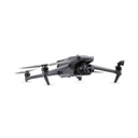
DJI Mavic 3 Thermal Worry-Free Plus Combo (C2)
- High-Resolution Camera: Equipped with a 20 MP sensor and capable of capturing 5.1K video.
- Thermal Imaging: Integrated thermal camera with high resolution for accurate temperature measurement.
- Advanced Obstacle Avoidance: Omnidirectional obstacle sensing and avoidance for safe flight.
- Extended Flight Time: Up to 46 minutes of flight time on a single charge.
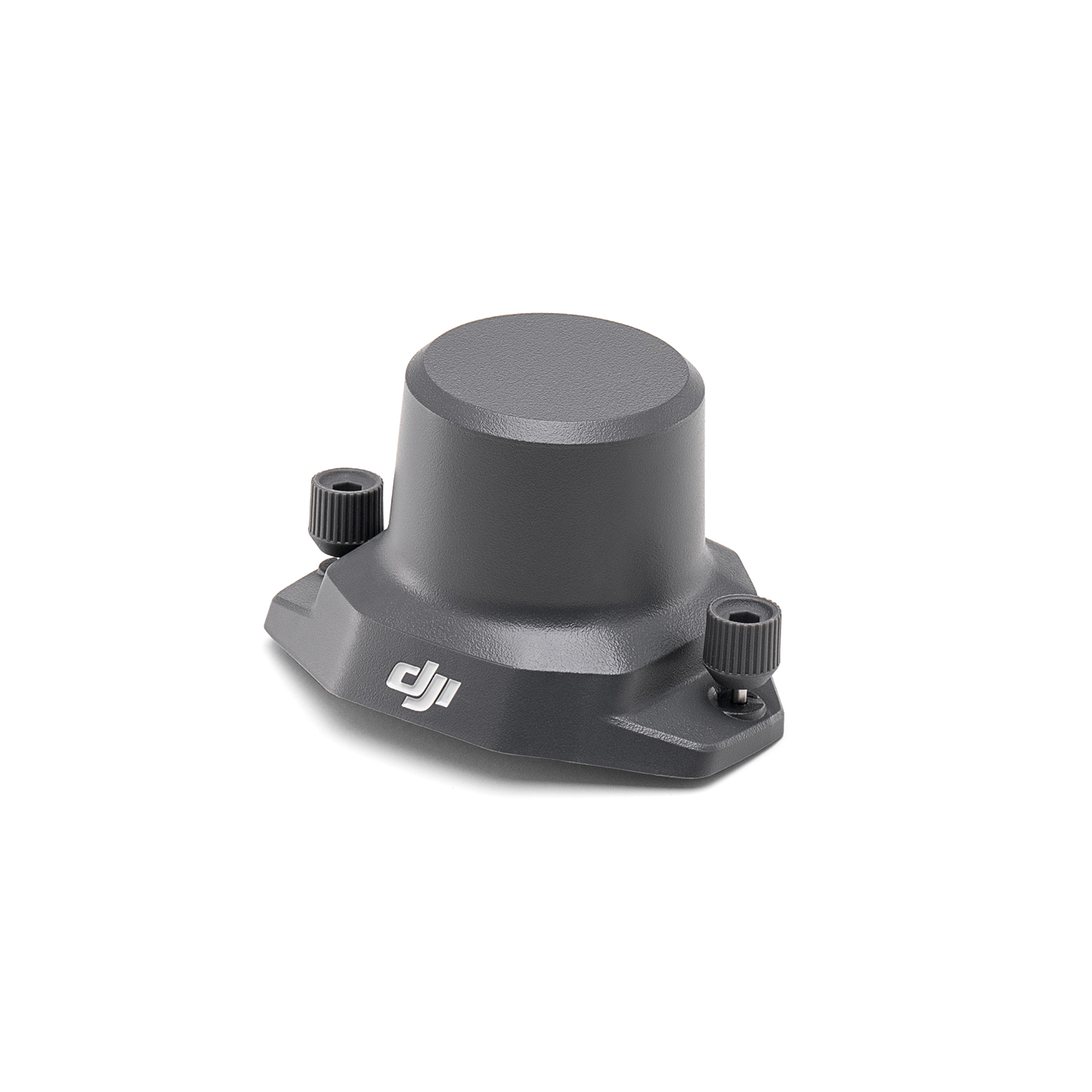
- RTK Module: Enhanced positioning accuracy with optional RTK module.
- Smart Controller: Comes with a smart controller featuring a high-brightness display for outdoor use.
- Long Transmission Range: Up to 15 km transmission range with O3+ transmission system.
- Multiple Flight Modes: Includes intelligent flight modes like ActiveTrack, Point of Interest, and Waypoints.
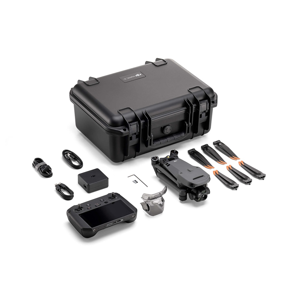
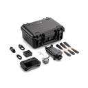
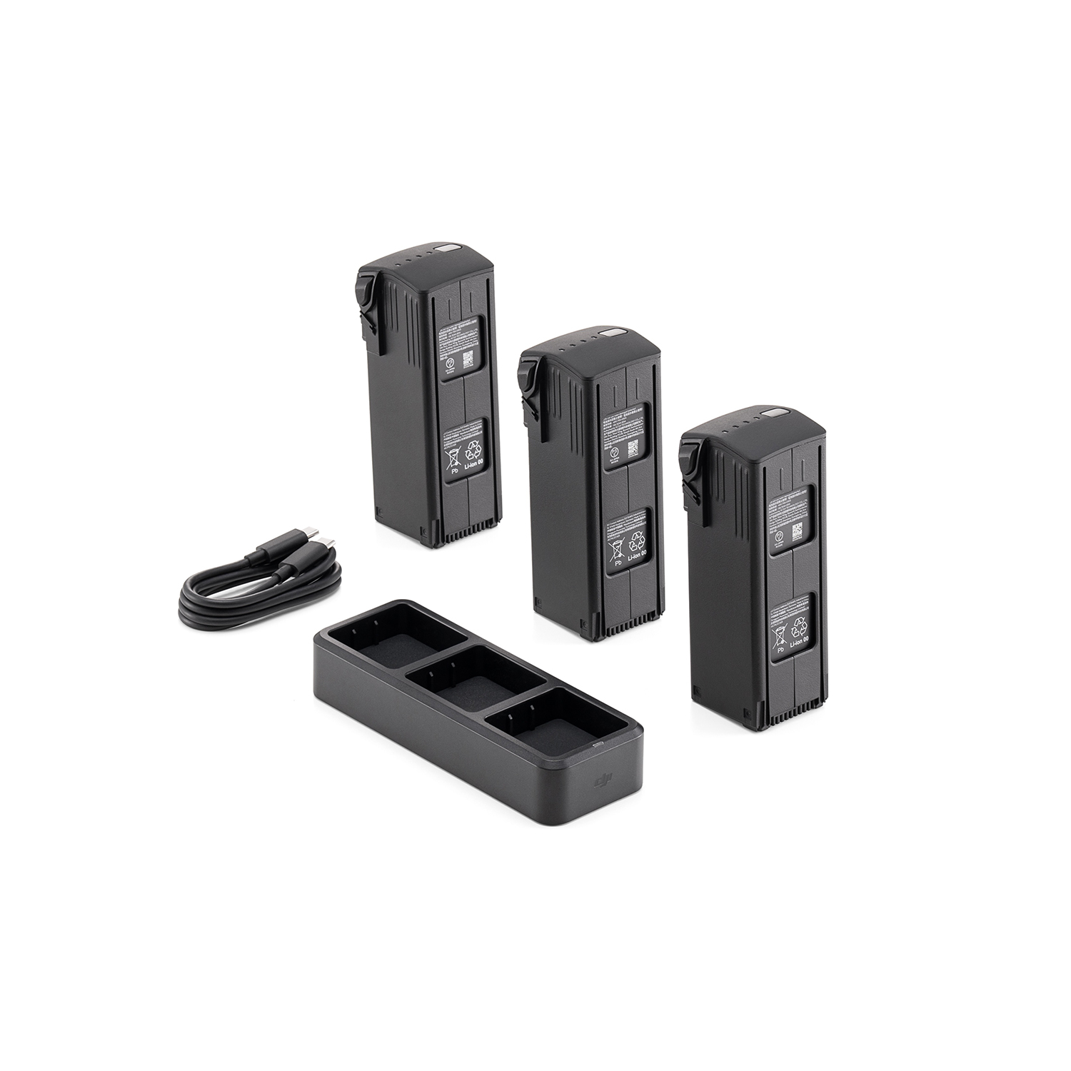
- Comprehensive Combo Package: The Worry-Free Plus Combo includes additional batteries, a charging hub, a carrying case, and other essential accessories for extended use and convenience.
This combo is immediately compliant with the new Cx regulations starting from January 1, 2024, with the C2 designation.
specs
|
Brand |
DJI |

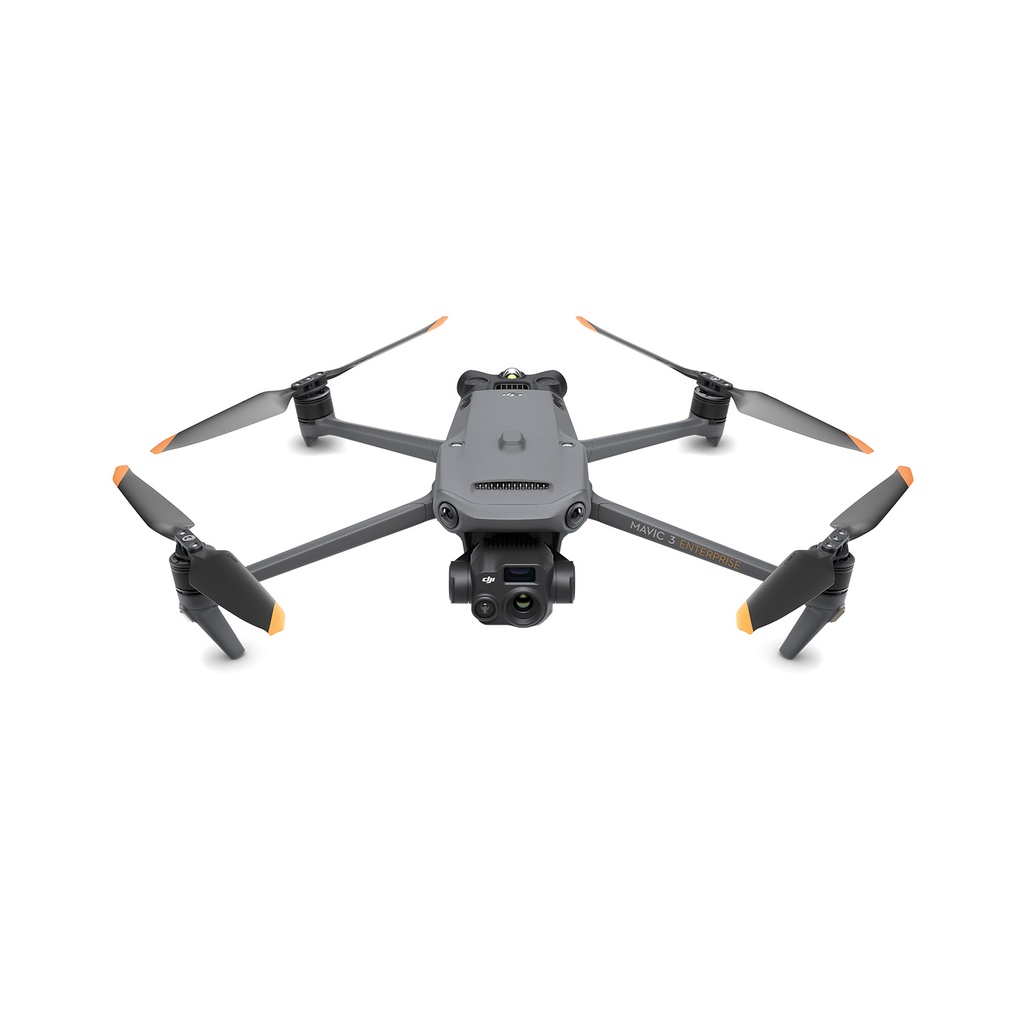
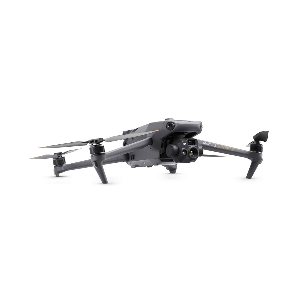
Compact and Portable
The streamlined and compact Mavic 3 Enterprise series can be carried in one hand and deployed in an instant. Perfect for both novice and advanced pilots, it is built to perform on long missions.
Premium Camera Performance
Swift Investigation
The Mavic 3E's 4/3 CMOS wide-angle, 20MP sensor has a mechanical shutter to prevent motion blur and supports fast interval shots of 0.7 seconds. Complete mapping missions with extraordinary efficiency without the need for Ground Control Points.
Enhanced Low-Light Performance
De Wide camera van de Mavic 3E heeft grote 3.3μm pixels die, samen met de intelligente low-light modus, aanzienlijk betere prestaties bieden in schemerige omstandigheden.
Focus and Locate
Both the Mavic 3E and the Mavic 3T are equipped with a 12MP zoom camera, supporting a maximum hybrid zoom of up to 56× to see essential details from afar.
Zie het ongeziene
The Mavic 3T's thermal camera has a resolution of 640 × 512 and supports temperature measurements of points and areas, high-temperature alerts, color palettes, and isotherms to help you locate your targets and make quick decisions.
Simultaneous Split-Screen Zoom
The Mavic 3T's thermal and zoom cameras support side-by-side continuous zoom of up to 28× for easy comparisons.
Exceptional Operational Efficiency
Optimized Batteries for Durability
With a flight time of 45 minutes, you can cover more ground per mission, mapping up to 2 square kilometers in a single flight.
Max Flight Time: 45 minutes
Single Flight Coverage: 2 square kilometers
Omnidirectional Detection for Safe Flight
Equipped with wide-angle lenses on all sides to avoid obstacles omnidirectionally without blind spots. Adjust proximity alerts and braking distance according to mission requirements.
Advanced RTH automatically plans the best route home, saving energy, time, and hassle.
APAS 5.0 allows for automatic rerouting around obstacles, allowing you to fly with peace of mind.
Comprehensive Software Suite
DJI Pilot 2
A redesigned Enterprise flight interface designed to enhance pilot efficiency and flight safety. Drone and payload controls are easily accessible with a single touch. Clear presentation of flight details and navigation information improves user experience, along with support for different types of routes.
DJI Flighthub 2
Integrated cloud drone operations management for your fleet with support for live annotations and cloud mapping for seamless synergy between the field and the cloud. Efficient management of inspection activities with route planning and mission management.
DJI Terra
Comprehensive mapping software for all stages of work, from mission planning to 2D and 3D model processing.
DJI Thermal Analysis Tool 3.0
Analyze, annotate, and process images captured by M3T with DTAT 3.0 to detect temperature differentials during your inspections.
Others also viewed
VIEW ALL DRONES
uw experten
Als uw turnkey drone solutions experten staan we steeds voor u klaar om onze kennis en ervaring te delen en u optimaal te ondersteunen.
contacteer ons