Survey Pack Basic (C1)
€4.168,51 €
3.699,00 save €470
excl. BTW 21%- DJI Mavic 3 Enterpise met RTK Module (C1)
- DJI Mavic 3 Enterprise Battery Kit
- DJI Cellular 4G Dongle
- Droprise GCP set (5 Pcs.)
- DJI TERRA Pro License (1 Year)
Survey Pack Basic PLUS (C1)
€5.448,67 €
4.849,00 save €600
excl. BTW 21%- DJI Mavic 3 Enterpise met RTK Module (C1)
- DJI Mavic 3 Enterprise Battery Kit
- DJI Cellular 4G Dongle
- Droprise GCP set (5 Pcs.)
- DJI TERRA Pro License (1 Year)
Included in this package:
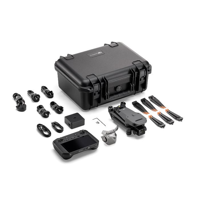
Drone
The Mavic 3 Enterprise (Mavic 3E) series redefines industry standards for small commercial drones. This combo is immediately ready for the new Cx regulations starting from January 1, 2024, with the C2 designation.
- Compact and portable
- Maximum flight time of 45 minutes
- Wide CMOS 4/3 camera
56× hybrid zoom
- DJI O3 Enterprise transmission
- Centimeter-precise positioning with RTK
The Worry-Free Basic Combo provides up to two affordable replacements. After paying the corresponding replacement fee, you can have your damaged product replaced with a well-functioning one*. The Worry-Free Plus Combo provides a coverage amount equivalent to the product's value.
Drone
The Mavic 3 Enterprise (Mavic 3E) series redefines industry standards for small commercial drones. This combo is immediately ready for the new Cx regulations starting from January 1, 2024, with the C2 designation.
- Compact and portable
- Maximum flight time of 45 minutes
- Wide CMOS 4/3 camera 56× hybrid zoom
- DJI O3 Enterprise transmission
- Centimeter-precise positioning with RTK
The Worry-Free Basic Combo provides up to two affordable replacements. After paying the corresponding replacement fee, you can have your damaged product replaced with a well-functioning one*. The Worry-Free Plus Combo provides a coverage amount equivalent to the product's value.
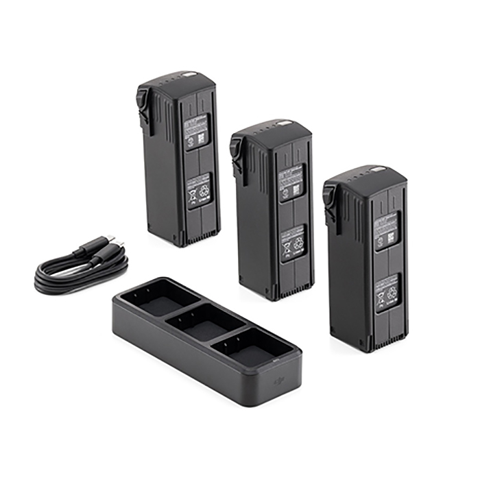
Batteries
DJI Mavic 3 Enterprise Series Battery Kit contains three Intelligent Flight Batteries and a DJI Mavic 3 Battery Charging Hub (100W) to meet the needs of long-term operations. These Li-Po batteries have a capacity of 5000mAh, providing a maximum flight time of 45 minutes per battery.
Charge up to three batteries simultaneously with the Charging Hub. This hub is compatible only with the DJI Mavic 3 USB-C Power Adapter 100W, available in optional accessories.
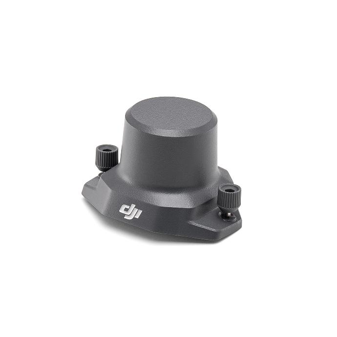
RTK module
The DJI Mavic 3 Enterprise RTK module is designed for seamless integration with DJI Mavic 3 Enterprise drones, offering centimeter-level positioning accuracy. It works efficiently with the Network RTK service, Custom Network RTK service, or the D-RTK 2 Mobile Station. With its low power consumption and high performance, this RTK module ensures precise positioning. For optimal accuracy, use it in open areas clear of buildings and other obstructions.
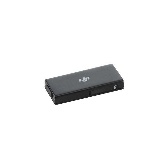
4G Dongle
This module allows you to connect to the 4G network, enabling you to benefit from enhanced map transmission, network RTK livestream options, and other features. The module provides fast and stable network services and supports most 4G bands worldwide. Please note that this module does not include a SIM card. For optimal performance in map transmission, it is important to operate the drone in a location with a strong 4G signal from the remote control or mobile phone.
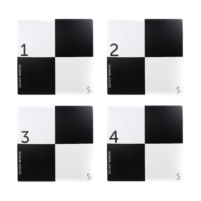
Ground Control Points
In an aerial mapping survey, GCPs are points which the surveyor can precisely pinpoint: with a handful of known coordinates, it’s possible to accurately map large areas.
Ground control points can be anything that can be easily recognized in the images. Typically they look like a small section of a checkerboard. The shape leaves very little ambiguity about where the ‘point’ of a ground control point is.
They’re almost always black and white because it’s easier to recognize high contrast patterns.
DJI Terra (Basic Plus only)
DJI Terra is a 3D model reconstruction software that has photogrammetry as its core technology. It supports a range of accurate and efficient 2D and 3D reconstruction of visible light, and data processing through DJI LiDAR. DJI Terra is a perfect match for DJI Enterprise drones and payloads. It works in conjunction to build a complete application solution that caters to vertical scenarios such as land surveying and mapping, power transmission, emergency services, construction, transportation, and agriculture.

uw experten
Als uw turnkey drone solutions experten staan we steeds voor u klaar om onze kennis en ervaring te delen en u optimaal te ondersteunen.